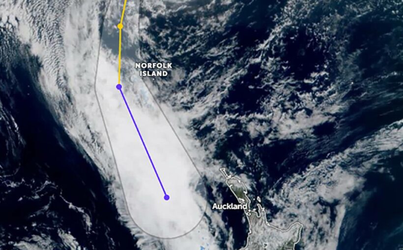
Don’t put the rain jacket away just yet as more heavy rain is set to hit large areas of New Zealand, as Cyclone Dovi reaches the country.
Dovi started as a tropical low between Vanuatu and New Caledonia but has since turned into a cyclone.
MetService is warning of heavy rain, wind and swells across the country, in particular the central districts of New Zealand.
A Strong Wind Watch for Auckland and Great Barrier Island has been issued by MetService, valid from Saturday, at 9pm. There is a risk of severe gales.
Heavy Rain Warnings and Watches are also in place for central areas from Taranaki to Buller, along with Strong Wind Watches for northern and central New Zealand.
“The culprit behind all the recent rain and almost unbearable humidity across much of the country has been a constant feed of very warm and humid air from the subtropics. Apersistent northerly wind flow has kept this warm airmass floating around the top of the North Island,” MetService meteorologist Lewis Ferris explained.
“Areas already sodden from the last week’s rainfall will be watching this coming rain event closely. It is already the wettest month on record at Westport airport coastal station (records began 1944) – 470mm and counting. That’s more than three times an average February amount for that station,” Ferris added.
The heavy rain watches are in place from Friday evening through to Sunday, from Taranaki to Buller.
Heavy rain is forecast to accumulate before Dovi even makes it near the shores of New Zealand.
“As the low-pressure centre gets closer, we will start to feel more wind (Strong Wind Watches in place) and there’s the potential for dangerous swell for western coasts of the North Island this weekend too,” the MetService meteorologist warned.
Weather Watch has also warned of flooding risks for areas of the country as Dovi approaches.
The storm is expected to fall apart in the New Zealand area but early estimates are that it will likely dump about 150 to 250mm of rain across a large portion of central New Zealand, in the upper South Island and the lower North Island.
Muggy weather set to continue
Earlier this week, a meteorologist warned the hot and humid weather that some are enduring across the upper North Island is expected to stick around until early next week.
MetService meteorologist Peter Little said the conditions are a result of the weather system which saw heavy rain hit the West Coast last week.
“That [weather system] has stalled over the north of the country so all the humidity associated with that system is hanging around and unfortunately it’s set to actually spread southwards,” said Little.
Niwa forecaster Nava Fedaeff told the Herald that the conditions are also due to air travelling from the tropics north of New Zealand.
“While we can’t travel to many tropical places at the moment, the air is coming to us instead and so it does feel almost Fiji-like in Auckland at the moment,” Fedaeff said.
Source: Read Full Article

/cloudfront-ap-southeast-2.images.arcpublishing.com/nzme/VAISWOOWLPHXWYLOT3F7IIMJKA.jpg)