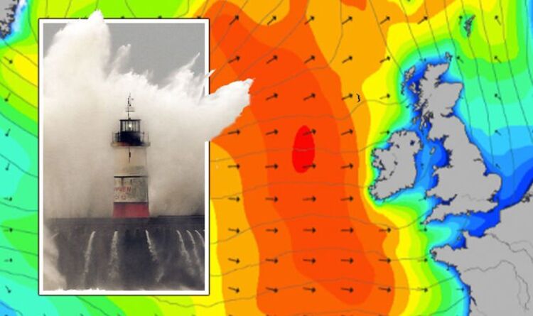
BBC Weather: Gusty winds throughout UK ahead of heavy rain
We use your sign-up to provide content in ways you’ve consented to and to improve our understanding of you. This may include adverts from us and 3rd parties based on our understanding. You can unsubscribe at any time. More info
Heavy downpours and gusts are expected to hit the west of the UK in the coming days, with night time temperatures set to plummet below freezing for some parts of the country. The north west of the country will be hit the hardest, with the Scottish Highlands expected to see some snowfall overnight on Wednesday into Thursday after it was battered by gale force winds up to 70mph this morning.
Snowfall could reach up to 5cm in Scotland by Thursday while the Republic of Ireland could also see some snow covering as temperatures drop.
The west of the UK and the north west of England are also expected to feel a chill in the coming days as stormy conditions close in towards the end of the week.
Parts of the Republic of Ireland and areas in north west Scotland may be hit by heavy rain from Wednesday into Thursday, while rain is also forecasted in areas of England’s south west coast on Friday into Saturday.
Weather forecasters have predicted conditions will worsen as the weekend nears, with a brutal pressure collision bringing wet and stormy weather to west of the UK while the east of England enjoys calmer and warmer weather.
Brian Glaze from the weather outlook told Express.co.uk: “The weather is looking mixed through the coming days.
“With the UK sandwiched between high pressure to the east and areas of low pressure to the west there is uncertainty in the forecast.
“This weekend wet and very windy conditions will probably push into the west of the UK. Generally the wettest conditions will be in the west and in the east it could feel quite spring like at times in the next week.”


BBC weather forecaster Carol Kirkwood noted on Wednesday that gusty winds will last throughout the rest of the week in the west where heavy rain will also close in on areas.
She noted that “heavy and persistent rain” would pour down across Scotland and Northern Ireland while a “cold undercurrent” coming in across the North West would see temperatures drop.
The BBC warned that showers, hail and thunderstorms could be seen in parts of the north and north west on Thursday night.
Forecasters have warned that the stormy weather gripping the west on Wednesday into Thursday will taper off briefly before another storm approaches on Friday, bringing rain and showers from the west.
Alyssa Smithmyer, a meteorologist from AccuWeather, told Express.co.uk: “Today, a frontal boundary is lingering across the central UK and bringing outbreaks of rain to the western and central regions. Across Northern Ireland and western Scotland today, blustery winds will gradually taper off as the front shifts eastward.


“On Thursday, a few showers will persist across the west and central areas but be much lighter in nature than on Wednesday. By Friday, another frontal boundary will arrive across the UK and bring another round of rain and showers. The rain will spread from west to east and arrive along the eastern coastlines later in the day.”
Meanwhile, the east and south of the country will enjoy sunny periods and warmer temperatures than parts of the west as areas get a long-awaited taste of springtime.
Areas of the south and east could see highs of up to 15 degrees on Thursday with warmer conditions than usual before the stormy conditions close in this weekend.
Jim Dale, senior meteorologist at British Weather Services told Express.co.uk: “We are in a kind of yo-yo period now, a transition between winter and spring, when it’s not unusual to see a changeable, mixed type of weather.
“So you can get a good day like it was in most places yesterday and then it turns and you get a wet day and wind involved, like some winds in Northwest Scotland today, for example.”
Although milder temperatures are expected into next week, Mr Dale warned that the unpredictable time of the year meant that weather could change rapidly and plunge Britain back into winter.
DON’T MISS:
‘Arrogant Putin crumbling!’ Russia mocked as only ONE goal achieved [BREAKING]
Ukraine LIVE: Putin on alert as UK and NATO poised to deploy 5k-strong [LIVE]
Ex-EU chief Donald Tusk takes swipe at Boris Johnson [LATEST]

He said: “At this time of year you can go in any direction very quickly, depending on the synoptics, the wind direction, the air stream involved. So it doesn’t take much to tip us over one edge or the other and that’s about where we are at the moment.”
Mr Dale said it was possible that the UK could be hit by yet more dramatic weather as the country still reels from being battered by three consecutive storms last month.
Storm Dudley, Storm Eunice, and Storm Franklin caused mass disruption across the UK, prompting the Met Office to issue multiple red alerts warning of a potential “danger to life”.
The Met Office issued four flood alerts on Tuesday for Norfolk, Cambridgeshire, Devon and other areas as the country still struggles to recover from the damage caused by the storms.
Mr Dale said: “Don’t think for one second that we can’t get winter back in through the north because it can happen – even up to early April time there’s every chance that you can get a wintry blast, which occasionally does happen.”
He added: “Normally this time of year the turbulence usually ramps up. We’ve just had some of that, so we probably had our fill for a little while. That isn’t to say that we can’t get another storm. That can happen, there’s no doubt about that.”
Source: Read Full Article
