BBC Weather: UK warned of heavy showers
When you subscribe we will use the information you provide to send you these newsletters. Sometimes they’ll include recommendations for other related newsletters or services we offer. Our Privacy Notice explains more about how we use your data, and your rights. You can unsubscribe at any time.
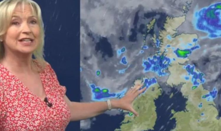
Carol Kirkwood has forecast thundery and scattered showers across the UK on Monday morning with northern Scotland expected to face the most challenging conditions. The meteorologist told BBC Breakfast showers in Northern Ireland and northern England will ease off in the coming hours and those regions will see dry weather in the afternoon.
Ms Kirkwood said: “We have got a bit of everything in the weather forecast in the next few days.
“After some torrential rain that led to flash flooding in Edinburgh yesterday, today we are looking at scattered heavy showers.
“There is still some rain in the far north of Scotland but in between there will be some sunny spells.
“The feature that brought the heavy rain is still with us and moving northwards.
“The radar picture is messy this morning, we have got showers and we have got some rain.”
She added: “The showery rain in the south will push away to the east.
“The showers in Northern Ireland and northern England will ease off, there will be some in the afternoon but some dry weather as well.”
The BBC’s long-range forecast for July 12-19 outlined more unsettled and wet weather for the UK.
BBC Weather: Torrential downpour to hit parts of the UK
The BBC wrote: “Through the middle of July, we expect that the most likely scenario is for a large-scale low pressure trough to persist over northern Europe, including the British Isles.
“This means that we should see a continuation of the cooler, wetter pattern as low pressure systems are often nearby or overhead.
“One complicating factor for the longer range forecasts this month is that the jet stream, a ribbon of fast-moving air in the upper atmosphere that helps drive weather fronts, is rather weak at the moment.
“This is normal for summertime, but it also means that low pressure systems that tend to move through and head east will instead stall and sit in place, lasting much longer.
DON’T MISS
UK hot weather forecast: 28C European heat heading for UK in HOURS [INSIGHT]
Carol Kirkwood sparks Dan Walker concern as weather report derailed [VIDEO]
When is hot weather coming back? UK maps predict when rain will END [ANALYSIS]
“However, it also means these lows will tend to be weaker, so it shouldn’t be particularly windy.
“Our best chances for warmer weather will be if the winds shift out of the southwest or south.”
The BBC added: “The main risk to the forecast is that high pressure in the Atlantic may build stronger into northern Europe than we expect.
“This would be a drier pattern for southern and eastern areas although wetter weather would still be possible in the west and north.
“Temperatures would also be a little warmer, rising slightly above average especially for southern areas.”
Source: Read Full Article


