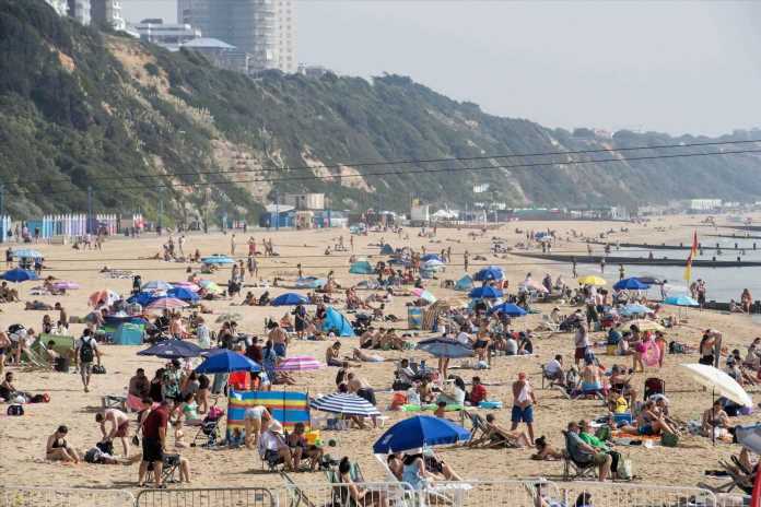
BRITS will lap up another day of sunshine today and it won't be the last as temperatures are set to hit 32C tomorrow – but thunderstorms are on the way.
Sun seekers took to beaches to soak up the rays yesterday and we can expect more of the same as the sunny temperatures continue into the weekend.
Snaps show beachgoers enjoying the fine weather in hotspots like Brighton, Bournemouth and Southend.
Many took a dip in the sea to beat the heat, while London's parks also filled to the brim.
The Met Office is predicting highs of 29C today and 32C tomorrow, with the hottest climes seen across London and the South East.
That's not to say, though, that the rest of the nation will miss out, with temperatures over 20C and sunny skies forecast in most areas.
Read More UK News
Moment cops think they’ve nabbed escaped Khalife but realise it’s a lookalike
Cops storm building after report of mass murder only to find YOGA CLASS
Only the far North East of Scotland is expected to see the mercury fail to break out of the teens.
However, the sunny days may be running out, with an increased chance of thunderstorms going into the weekend.
Met Office Deputy Chief Meteorologist Nick Silkstone said: "There’s a chance the thunderstorm risk for some central and western areas from Friday, but more especially Saturday onwards may require a warning response, with some potentially impactful downpours, though exact details on the likely positioning of these downpours are still being determined, and indeed many places may see little if any rain on Friday and Saturday."
A yellow weather warning is in place for tomorrow covering central and southern England and parts of West Wales between 2pm and 9pm.
Most read in The Sun

Shamed That 70s Show star jailed for 30 years for raping two women

Laura Anderson gives birth to baby girl with Gary Lucy and reveals adorable name

Queen is looking down on us, Harry says & reveals Meg ‘upset’ not to be UK

Real reason for Faye Winter and Maura Higgins’ shock NTAs bust-up revealed
Areas including Bath, Nottingham, Stoke-on-Trent and Manchester have been alerted to the chance of flash flooding, power cuts and lightning strikes.
Explaining the cause of the heat, Met Office meteorologist Steve Ramsdale said: "High pressure is situated to the South East of the UK, which is bringing more settled conditions and temperatures well above average for the time of year.
"While the highest temperatures are expected in the South, heatwave conditions have already been met for much of England and Wales, with parts of Scotland and Northern Ireland also likely to continue to see some unseasonably high temperatures."
And with a high of 32.6C, yesterday was the fourth consecutive day of temperatures above 30, meaning that the recent dry spell is officially a heatwave for 13 areas.
These include parts of West Yorkshire, Cornwall, Devon and Wales.
Heatwaves are defined as three or more consecutive days of temperatures above the official "threshold" for the local area, usually between 25C and 28C.
Steve added that this has been caused by an "active tropical cyclone season" pushing a "jet stream" of hot air up across the UK.
Named after the Greek letter omega because of its shape, the weather system is due to an area of high pressure being sandwiched between two areas of low pressure.
It is responsible for the heavy downpours and flooding seen in Spain and Greece this week, but has also brought hot and dry conditions fo much of the UK and central Europe.
Source: Read Full Article


