UK weather: Forecast predicts cloud with light rain and breeze
We use your sign-up to provide content in ways you’ve consented to and to improve our understanding of you. This may include adverts from us and 3rd parties based on our understanding. You can unsubscribe at any time. More info
Weather forecasts will have baffled Britons this summer, with both wall-to-wall Sun and ankle-deep flooding. Although conditions have started to level out, the country is now closer to autumn than summer. The latest forecasts show as much, with a mix of rain and cloud in the days to come.
When will it rain today?
Two pressure systems in the UK are currently deciding the country’s weather forecast.
Low pressure has settled in the east, while a higher pressure system has formed to the west.
Traditionally, low pressure brings unsettled weather, but the opposite is true today.


At present, a few patches of rain have broken out over eastern England.
Coastal areas, primarily around Norwich at Hunstanton and the tip of Hull at Withernsea and nearby Grimsby, have seen showers.
A few inland areas, including Leeds, York, and nearby Harrogate, have also seen rain.
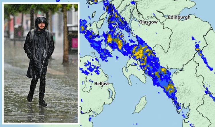
Most of the rain is currently drifting across the west coast.


A significant band pouring out 0.01 to 4mm of rain per hour is streaking to the northwest from the Midlands and will continue to move this way into the afternoon.
The worst has settled as a band stretching from northwest of Birmingham to between Manchester and Sheffield.
People will encounter totals up to 4 to 8mm (0.1 to 0.3 inches) of rain per hour, while neighbouring Liverpool sees limited showers.
A significant band currently stretches from the tip of the Lake District National Park in Cumbria up Scotland’s entire west coast.
DON’T MISS
Woman and dog save car from floodwater – PICTURES
Rat infestation warning: Pest control claim record numbers in homes – INSIGHT
Record-breaking 48.8C heatwave sparks red alert danger to life warning – FORECAST


Although some of the heaviest rain will settle there over the afternoon (between 4 and 8mm), it won’t venture far inland.
Rain radars show the bulk of the rain will fall across Dumfries and Galloway Forest Park up to Ayr to the southwest of Glasgow.
The Isle of Arran, Campbeltown and Islay also lie in the band’s path.
Northern Ireland will see limited showers break out around the north at Derry and Ballymena and in the south near Coleraine and Omagh.
The Met Office long-range weather forecast expects the rain will continue across the northwest UK for the rest of the week.
By next week, “plenty of dry weather” should follow with average temperatures.
As August ends, winds crossing across the south could allow some “very warm spells”.
But they could also bring “the chance of intermittent heavy rain and thundery showers.”
Source: Read Full Article
