BRITS have been warned of "blizzard conditions" and plummeting temperatures across the UK this weekend.
Yellow and amber warnings are in place from today until Monday and are expected to wreak havoc.
The Met Office have also warned of "prolonged periods of snow" with up to 30cm of snowfall in the higher areas.
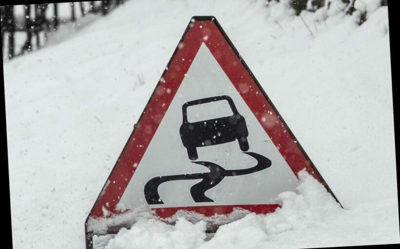
There are further warnings that the wild weather conditions could lead drivers stranded and cause power cuts in southern Scotland and northern England over the weekend.
Follow our weather live blog below for the latest news and updates from around the country
- Imogen Braddick
FORECAST FOR NEXT WEEK
Next week will stay chilly for much of the UK with brisk easterly winds making it feel even colder.
However, the weather is potentially drier than this week.
- Imogen Braddick
'BALTIC BEAST'
Severe weather warnings are in place until Monday.
A Met Office spokesman said: "We have just issued an amber warning for the South East, and the east coast of England including Kent and Suffolk which could see between 5 and 10 centimetres of snow."
They added Scotland can expect up to 11 inches of the white stuff, with the possibility for even higher snow drifts due to blizzards.
There are currently 36 flood warnings in place across parts of England, along the River Severn and the River Thames, put in place by the Environment Agency.
A thick blanket of snow fell in the north yesterday with Yorkshire and the North East of England forecast to catch the majority of snowfall today.
- Imogen Braddick
WEATHER WARNINGS
Here's a handy summary from the Met Office on the latest weather warnings across the UK.
- Claudia Aoraha
SIX WEATHER WARNINGS TOMORROW
A total of six weather warnings are in place for tomorrow, including one amber warning for snow.

- Imogen Braddick
AMBER WEATHER WARNING FOR PARTS OF ENGLAND
The Met Office has issued an amber weather warning for heavy snow in parts of England from Sunday at 4am.
Up to 20cm of snowfall is expected in parts of Kent, Essex, Suffolk and Norfolk.
"An area of widespread, persistent and occasionally heavy snow will affect parts of the southeast and east England throughout Sunday, with the potential for some significant accumulations across eastern parts of Norfolk, Suffolk, Essex and Kent throughout the day," the Met Office said.
"Very strong easterly winds with gusts around 50 mph are possible, which may lead to blizzard conditions for a time and the possibility of drifting of snow."
The new weather warning for England was issued at 11am today. An amber weather warning for snow is already in place in Scotland.
- Imogen Braddick
RAIN IN THE NORTH, SUNSHINE IN THE SOUTH
- Imogen Braddick
LOOKING AHEAD
Here's the latest forecast from Tuesday next week…
"A cold start to the period with significant wind-chill, especially in eastern areas. Snow showers are likely across eastern Scotland, England, and perhaps eastern Northern Ireland, whilst plenty of bright sunny weather is likely further west," the Met Office said.
"There is a small chance of a period of heavy snowfall across parts of southern England and Wales, most likely on Tuesday.
"As the period progresses, remaining cold or very cold with brisk winds. The best of any sunshine will be in the west.
"Snow showers and attendant wintry hazards continuing to affect eastern UK at times, especially at first, whilst the risk of organised rain and snow pushing into the south-west and across southern UK will slowly increase."
- Imogen Braddick
SNOW DRIFTS
Winter is tightening its grip across Scotland today, with two-metre snow drifts in some areas.
- Imogen Braddick
TRAPPED DRIVERS
Deep snow in the Highlands in Scotland trapped 20 drivers in their vehicles on the A835 between Ullapool and Garve, with a rescue mission underway.
Highland Council officials urged motorists: "Do not travel in this area."
Meanwhile, a thick blanket of snow fell in the north yesterday with Yorkshire and the North East of England forecast to catch the majority of snowfall today.
The onslaught will begin with heavy, icy showers before turning into full-on snow, forecasters said.
The white stuff is then due to hit the east of England before making its way down to London and the south.

- Imogen Braddick
'THE COLDEST PERIOD OF WINTER SO FAR'
The Met Office has warned of severe cold weather across England from Saturday to Wednesday, and upgraded the cold weather alert to Level 3 today.
"Very cold temperatures will spread to all parts of the country by the end of Sunday and into Monday morning – the coldest period of the winter so far," the Met Office warned in the amber alert.
There is a 90 per cent probability of severe cold weather between 9am on Saturday and 9pm on Wednesday, February 10 in parts of England, forecasters said.
"This weather could increase the health risks to vulnerable patients and disrupt the delivery of services," the alert says.
The highest cold weather alert level – a red Level 4 – signifies a national emergency, when period of cold weather is so severe that it impacts the health and social care system.
- Imogen Braddick
'MOST SIGNIFICANT SNOWFALL IN THREE YEARS'
Meteorologist Steven Keates told The Sun: "This will be the most significant snowfall we have had all at once since the Beast from the East three years ago.
"The blizzards will cause some quite significant travel issues and it is the amount of snow which could easily cut off isolated communities in Scotland.
"Next week the snow risk will move southwards into northern England through Monday and Tuesday.
"There will be a good covering of snow, especially on high ground.
"Temperatures will drop all across the UK, not just in Scotland."
- Imogen Braddick
COLDEST FEBRUARY IN 10 YEARS?
The Scandinavian blast comes as the UK gets set to endure what might be its coldest February in ten years.
Bookmaker Coral puts odds on at 4-5 that this February is the coldest the UK has ever had, with many parts set for more snow.
Coral's Harry Aitkenhead said: "The amount of rain we have endured this winter seems scarcely believable and it's been so wet that we now make this winter odds on to go into the record books as the wettest ever in the UK.
"Temperatures in the north of England and Scotland are remaining close to freezing and it is only 5-4 that this month is our coldest February of all time."
- Imogen Braddick
'BLIZZARD CONDITIONS'
Some areas of Scotland could be cut off between midday on Friday until Saturday evening.
The Met Office has warned parts of the country may see an additional foot-and-a-half of snow by the end of Saturday.
Mark Sidaway, Met Office deputy chief meteorologist, said: "Into the weekend, snow will continue across much of Scotland, and is likely to increasingly fall to low levels before beginning to move south into northern and eastern England.
"We are likely to see some very large accumulations across higher parts of Scotland especially, with strong winds leading to significant drifting and blizzard conditions at times."
- Imogen Braddick
'DIFFICULT CONDITIONS'
The view from a gritter driver's cab in Invergarry in Scotland amid yellow and amber weather warnings for snow.
- Imogen Braddick
FRIDAY FORECAST
The Met Office said Friday morning will be wet across parts of Northern Ireland, northern England and much of Scotland and there will be further significant falls of snow over the hills there.
It will be much milder further south, with a few sunny spells and a scattering of showers, forecasters said.
- Imogen Braddick
'HUGE AMOUNTS OF SNOW TO COME'
- Imogen Braddick
LATEST WEATHER WARNINGS
Yellow weather warnings for heavy rain are in place today for Belfast, Middlesborough, Newcastle, and the surrounding areas near Leeds and York.
And yellow and amber weather warnings are in place for snow in Scotland today.
- Imogen Braddick
WHEN WILL THE SNOW HIT?
Snow is set to fall in London and the south of Britain on Saturday.
A yellow weather warning for snow and ice will cover much of England while Scotland has been issued an amber warning.
London and the South East, the East Midlands, the North East, the North West and parts of the South West will all be affected from tomorrow.
The Met office said there is a chance of travel delays on roads with some vehicles and passengers becoming stranded, along with delayed or cancelled rail and air travel.
- Ben Hill
BRRRRR-MINGHAM
Birmingham faces lows of minus 2C by Tuesday morning, while a strong easterly wind will make it feel many degrees below freezing in some parts, according to Met Office forecaster Steven Keates.
He said it will be "really unpleasant" to be outdoors, adding: "If you do have to go outside there are lots of layers required I think."
Mr Keates said the south will see a "marked" drop in temperatures across Saturday and Sunday, with some parts possibly seeing as much as 5-10cm of snow.
"Enough snow is on the cards I think to cause potentially quite a bit of disruption in the south east of England through Sunday, and potentially very early next week as well," he said.
- Ben Hill
BIG CHILL
Temperatures are set to drop over the first February weekend, with much of the UK braced for a wintry chill.
The mercury could plunge to freezing in some areas, while heavy snowfall may cause significant disruption to transport and power.
Weather warnings are in place over the next few days, with a warning for snow and ice covering the length of Britain from midday on Saturday to midnight on Sunday.
- Ben Hill
FORECAST FOR TONIGHT AND TOMORROW
Tonight: Daytime showers will continue across England and Wales, with clear spells developing.
Outbreaks of rain across Northern Ireland and northern England will continue before clearing overnight. Unsettled and overcast across Scotland with cloudy skies and outbreaks of snow which will be heavy at times.
Tomorrow: Saturday will be overcast with further snow expected across Scotland with significant accumulations possible.
Rain will fall increasingly as sleet and snow across southern Scotland and northern England. There will be scattered showers and outbreaks of rain across much of northern and eastern England.

- Patrick Knox
WINTER CHILL ON THE WAY FOR FIRST WEEKEND OF FEBRUARY
Temperatures are set to drop over the first February weekend, with much of the UK braced for a wintry chill.
The mercury could plunge to freezing in some areas, while heavy snowfall may cause significant disruption to transport and power.
Weather warnings are in place over the next few days, with a warning for snow and ice covering the length of Britain from midday on Saturday to midnight on Sunday.
By next week, temperatures will be struggling to get much above 0C in quite a few places, with some areas such as the Pennines and high parts of Scotland seeing several degrees below that.
- Patrick Knox
WEATHER FORECAST
Weekend weather forecast – Heavy snow to fall in London and south with severe weather warnings until next week
- Patrick Knox
OTTERS GET INTO SLEDGING
Perfect otter-shaped incisions were seen amongst the thick layers of snow, suggesting an otter had been sliding around his riverside home to explore.
This might even be better than spotting paw prints in the snow!
- Sarah Grealish
COLDEST FEBRUARY
Bookmaker Coral puts odds on at 4-5 that this February is the coldest the UK has ever had, with many parts set for more snow.
Coral's Harry Aitkenhead said: "The amount of rain we have endured this winter seems scarcely believable and it's been so wet that we now make this winter odds on to go into the record books as the wettest ever in the UK.
"Temperatures in the north of England and Scotland are remaining close to freezing and it is only 5-4 that this month is our coldest February of all time."
Source: Read Full Article