BRITS have been told to brace for a icy -1C freeze next week as the temperatures will drop in Scotland on Tuesday – just days before Christmas.
One forecaster says that if a particular weather system shapes up in the days to come, some areas could record a whopping 10 inches of snow on the big day.
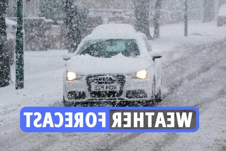
Meanwhile, forecasters have predicted the exact date Brits will see snow this month – with with blizzards and biting winds blasting in some parts of the country.
Brian Gaze of The Weather Outlook has said it may well be a very white Christmas after all, and it'll be an "all-time classic" for snow fans.
The charts show temperatures as low as -6C in parts of Scotland, while snow would fall across much of the country – including in the south.
Read our weather live blog for the latest news and forecasts
- Milica Cosic
Explained: What is winter solstice?
The winter solstice is the day with the shortest period of daylight each year. It happened yesterday – December 21.
It occurs twice – once for the northern hemisphere, and then again for the southern hemisphere.
The winter solstice 2021 date for the northern hemisphere is December 21.
A winter solstice happens when one of Earth's poles reaches its maximum tilt away from the Sun.
Nights will be their longest, and the Sun will appear at its lowest elevation in the sky.
At either pole during a winter solstice, darkness will be continuous.
- Milica Cosic
Next week to see cold and unsettled weather
By Tuesday night, the temperatures will drop to a chilly 1C for most, with slightly warmer weather in the south.
In Scotland, the mercury is expected to dip below zero, reaching -1 in Loch Rannoch – and it could dive to -5C in some parts on Christmas Day.
On the forecast for the week ahead, the Met Office said Sunday’s foggy weather will clear for a cloudy but brighter Monday.
Skies will clear into Tuesday and after a frosty start, it will be bright and sunny – and is “likely to be the best day of the week”.
But Wednesday will bring increasingly unsettled weather.
- Milica Cosic
Heaviest snow to arrive from next Monday
The heaviest of the snow is expected to arrive from next Monday as Storm Carrie sweeps into the UK.
The Corrie could move in and drop a “snowbomb”, Netweather.tv reports.
Weather charts suggest snow will fall in the North West on December 27, with 1cm expected in just one hour.
By December 28 – after continuous overnight blizzards – 2cm of snow per hour will come down across swathes of the North West, the south of Scotland, Southampton and Cardiff.
The white stuff could even hit London and the south of England on December 28, according to one prediction.
It will be bitterly cold across the UK this week with temperatures plummeting to zero.
- Milica Cosic
Up to £25 a week thanks to cold weather payments
If temperatures plummet below zero that could trigger a payment of £25 automatically.
Cold weather payments are made if it hits freezing between November 1 and March 31, to help you pay for the increased energy costs.
The temperature will have to stay that low for seven consecutive days before the cash is handed out.
So far the payment has not been triggered anywhere because the weather hasn't gotten that cold – yet.
There's still time for it to happen as the scheme doesn't close for another month – it could be more likely that it will happen in January or early February though.
You can check if the payment applies to you using the government's postcode checker any time between now and the spring.
You must already be getting certain benefits to qualify, including pension credit, income support, jobseeker's allowance, income-related employment and support allowance, and Universal Credit.
You won't qualify if you are in a care home or subject to immigration control.
You don't need to apply for the extra payment – it's paid automatically into your bank or building society account within 14 days of the cold spell ending.
- Joseph Gamp
Heavy snow will hit south coast on December 27
Meteorologists earlier predicted snow could arrive as early as Friday in the South, while the Met Office warned blizzards could be in store for Scotland.
The Met said conditions will be mild on Thursday before rain sets in, but don't let that dampen your spirits.
"Colder and clearer" conditions are set to take hold on December 25, with northern parts of the country most likely to see snow.
Meanwhile, the Weather Outlook suggest "heavy snow" will hit the south coast on December 27.
- Joseph Gamp
Met Office: Changes in store with tomorrow's weather
The Met Office said: "There's some changes in store #weather wise on Wednesday.
"After a bright and frosty start for many, cloud and some #rain will arrive from the southwest.
"Here's the #4cast."
- Joseph Gamp
‘Heavy snow’ possible in south
Temperatures are set to plummet over the festive period as Storm Corrie sweeps in, bringing blankets of the snow along with it.
The Weather Outlook suggest “heavy snow” will hit the south coast on December 27.
Meteorologists predict snow could arrive as early as Christmas Eve in the South, while the Met Office warned blizzards could be in store for Scotland.
“Colder and clearer” conditions are set to take hold on December 25, with northern parts of the country most likely to see snow.
- Joseph Gamp
London weather summary for Wednesday
A bright and frosty start. Cloud thickening through the day, with chance of patchy light rain later.
Most parts remaining dry though.
Feeling cold. Maximum temperature 8 °C.
- Joseph Gamp
Long range forecast from December 26 – January 4
The Met Office says this period "remains somewhat uncertain in detail, but generally sees a split between colder air to the north and milder air to the south.
"Snow showers are looking to continue across far northern areas, with perhaps some mainly light rain or snow for southern locations. To the south, mild, unsettled weather, with rain and occasional strong winds."
It continued: "To the north more settled conditions with brighter spells and perhaps some frost or ice. Feeling very cold in brisk northeasterly winds for many. Along the boundary, potential for significant weather with snow likely at times in addition to possibly strong winds.
Becoming colder than average heading into January with any unsettled, milder spells most likely for the west and south.
- Joseph Gamp
Met Office weather summary for Wednesday
The Met Office says it will be "fine and dry for many areas at first.
"Cloud and rain soon developing in the west though and then then spreading eastwards, rain turning to snow over hills in Scotland."
- Joseph Gamp
Will we see snow on the 23rd?
Maps from WXCharts show snow and rain sweeping into Scotland and the north of England on December 23.
Snow is also set to sprinkle most of the country on Christmas Eve and Christmas Day, particularly in the north of England and much of the Midlands, according to the maps.
The south of England might not wake up to snow on the big day, but they could see a dusting by 6pm and overnight into Boxing Day.
- Joseph Gamp
Driving home for Christmas – the checklist
StressFreeCarRental.com are providing motorists with their Christmas road trip checklist for those looking to pack up their cars and hit the roads this winter.
A few simple checks will help significantly to help drivers relax and enjoy the Christmas songs on their journey.
- Presents – Most importantly of all, drivers should ensure they have all of their presents and cards on board before setting off on their festive journey!
- Emergency kit – On dark wintery nights, driving conditions can change drastically and leave drivers in a situation they were not prepared for
- Lights – As the days get shorter, ensuring all vehicle lights are functioning properly is not only essential but also a legal requirement.
- Tyres – Snow, sleet, rain and frost can all have a huge impact on the terrain, meaning tyre upkeep is more important than ever in the winter months.
- Windscreen – Winter weather can be unpredictable and having full visibility can prevent any potential dangers on the road.
- Antifreeze – It is crucial when topping up your antifreeze that the engine has fully cooled down, as the release of pressurised water can cause serious injury
Weather summary for Thursday to Christmas Day
Mild with rain for many Thursday, then on Friday and Saturday (Christmas), colder air starts to push south, with some sleet/snow falling to lower levels in the north.
Snow could arrive in the south on Xmas Eve, says expert
Meteorologist James Madden, from Exacta Weather, told the Express: “Snow could arrive as early as Christmas Eve in parts of the south.
“Further snow is likely during the latter part of Christmas Day and on Boxing Day.”
He added: “Temperatures could also dip as low as -10C in the coldest and iciest areas over the festive period.”
Will we see snow on the 23rd?
Maps from WXCharts show snow and rain sweeping into Scotland and the north of England on December 23.
Snow is also set to sprinkle most of the country on Christmas Eve and Christmas Day, particularly in the north of England and much of the Midlands, according to the maps.
The south of England might not wake up to snow on the big day, but they could see a dusting by 6pm and overnight into Boxing Day.
- Milica Cosic
‘Heavy snow’ possible in south
Temperatures are set to plummet over the festive period as Storm Corrie sweeps in, bringing blankets of the snow along with it.
The Weather Outlook suggest "heavy snow" will hit the south coast on December 27.
Meteorologists predict snow could arrive as early as Christmas Eve in the South, while the Met Office warned blizzards could be in store for Scotland.
"Colder and clearer" conditions are set to take hold on December 25, with northern parts of the country most likely to see snow.
- Milica Cosic
Driving home for Christmas – the checklist
StressFreeCarRental.com are providing motorists with their Christmas road trip checklist for those looking to pack up their cars and hit the roads this winter.
A few simple checks will help significantly to help drivers relax and enjoy the Christmas songs on their journey.
- Presents – Most importantly of all, drivers should ensure they have all of their presents and cards on board before setting off on their festive journey!
- Emergency kit – On dark wintery nights, driving conditions can change drastically and leave drivers in a situation they were not prepared for
- Lights – As the days get shorter, ensuring all vehicle lights are functioning properly is not only essential but also a legal requirement.
- Tyres – Snow, sleet, rain and frost can all have a huge impact on the terrain, meaning tyre upkeep is more important than ever in the winter months.
- Windscreen – Winter weather can be unpredictable and having full visibility can prevent any potential dangers on the road.
- Antifreeze – It is crucial when topping up your antifreeze that the engine has fully cooled down, as the release of pressurised water can cause serious injury.
Explained: Claiming compensation if gas or electricity is cut off because of snow
Households who have power cut off due to the snow could be due compensation from firms.
How much you can claim depends on how long the disruption lasts – and how severe the weather is.
According to Citizens Advice, if a power cut is caused by bad weather, you’ll be entitled to £70 compensation if you’re without power for 24 hours, with another £70 paid for each of the following 12 hours up to a maximum cap of £700.
In really bad weather, the time-limit is 48 hours before compensation kicks-in – a severe storm is defined by regulator Ofgem as causing more than 12 times the average daily number of faults.
Energy expert and ex-British Gas worker Lynsey Jones shares her tips for savings on bills.
Get help with budgeting loans
You may be able to get a budgeting loan from the Social Fund to help with intermittent expenses.
You're more likely to be eligible if you receive pension credit, income support, income-based jobseeker’s allowance or income-related employment and support allowance.
Universal Credit claimants will need to apply for a budgeting advance – these are interest free loans, but must be paid back.
You will need to have been receiving benefits for more than six months before applying.
The payments are designed to help with intermittent expenses which are difficult to budget for, such as the cost of installing a prepayment meter or connection charges if you move home.
Up to £25 a week thanks to cold weather payments
If temperatures plummet below zero that could trigger a payment of £25 automatically.
Cold weather payments are made if it hits freezing between November 1 and March 31, to help you pay for the increased energy costs.
The temperature will have to stay that low for seven consecutive days before the cash is handed out.
So far the payment has not been triggered anywhere because the weather hasn't gotten that cold – yet.
There's still time for it to happen as the scheme doesn't close for another month – it could be more likely that it will happen in January or early February though.
You can check if the payment applies to you using the government's postcode checker any time between now and the spring.
You must already be getting certain benefits to qualify, including pension credit, income support, jobseeker's allowance, income-related employment and support allowance, and Universal Credit.
You won't qualify if you are in a care home or subject to immigration control.
You don't need to apply for the extra payment – it's paid automatically into your bank or building society account within 14 days of the cold spell ending.
'A White Christmas is definitely on'
Meteorologist James Madden, from Exacta Weather, told the Express: "Snow could arrive as early as Christmas Eve in parts of the south.
"Further snow is likely during the latter part of Christmas Day and on Boxing Day."
He added: "Temperatures could also dip as low as -10C in the coldest and iciest areas over the festive period."
Jim Dale, of British Weather Services, added: "A White Christmas is definitely on.
“It will get colder through next week as high pressure breaks down and a system coming in on Christmas Eve clashes with cold conditions and brings snow.
"There is a chance of snow any time in any place."
- Milica Cosic
Snow on the big day!
Maps from WXCharts show snow and rain sweeping into Scotland on December 23.
The band of snow gradually moves south, blanketing parts of the north of England, and much of the Midlands and north Wales on Christmas Day, according to the maps.
Those living in Newcastle, Leeds, Manchester, Stoke, Liverpool, Birmingham, and parts of north Wales could see the white stuff falling by 6pm on the big day.
Bookmaker Coral said that odds for a White Christmas have been slashed for all major UK cities – with Edinburgh topping the betting for the most likely to see snow and Newcastle just behind.
- Milica Cosic
‘Snowbomb’ to hit in DAYS
The UK will be plunged into freezing temperatures as it could be hit by a "snowbomb" in just a few days.
Most areas within the UK are also set be covered in the white stuff on Christmas Day.
The Met Office said snow could be possible for some parts of Britain on December 25, while much of the country is set to see very cold but bright weather.
Meteorologist Annie Shuttleworth said the snow flurries could arrive earlier than December 27 – and there's still a good chance some Brits will see snow on Saturday.
The white stuff could fall in parts of the UK as early as Thursday as temperatures plunge this week, according to one prediction.

Snow is forecast to hit parts of the UK on the evening of Christmas DayCredit: WXcharts - Milica Cosic
Weather outlook for Thursday and Friday
The rain will continue on Thursday, with all areas seeing some rain, heaviest over Scotland in the evening.
There may be some bright spells for eastern England. Friday will start cloudy, with drizzle for Scotland.
A band of rain and showers will then move into England, Wales and Northern Ireland.
- Milica Cosic
Tomorrow's weather
A sunny start for England tomorrow but cloudy in other areas before a band of rain moves in, affecting mainly Northern Ireland and Scotland tomorrow afternoon and through the evening.
This will bring heavy rain in places, turning wintry for some in Scotland.
It will remain dry for southern England
Source: Read Full Article
